RuinDossenheim

Kronenburg Castle (Ruin)

Kronenburg Castle (Ruin)

The remains of the ruins can be visited

Kronenburg refers to a group of castle ruins near Dossenheim in the Rhein-Neckar-Kreis in the northwest of Baden-Württemberg.

The remains of the castle complex are located at an altitude of approximately 300 meters on a spur in the Odenwald, which divides the Dossenheim Mühltal to the west and is flanked to the north and south by two spring streams. An old path to the Neckar and Steinachtal runs through the valley to the south. Not far to the northwest lies Schauenburg, and remains of another castle are located southwest in the area known as "im Wolfsgrund".

The group of castles has not yet been historically classified. Speculations that they are predecessors of Schauenburg could not be substantiated. There are no documentary mentions. The building findings suggest the 11th or early 12th century. The name Kronenburg originates from the 19th century. The traditional name is Altes Schlössel.

Layout+

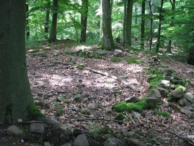
Only sparse remains of the structures have survived. However, the artificial shaping of the now tree-covered terrain is clearly visible.

The East Castle is separated from the saddle by two outer ramparts. To the north and west, it is surrounded by a small rampart, which probably continued to the south until the construction of a forest road. Only loose rubble walls remain of the curtain wall. On the polygonal plateau, 60 meters long and 45 meters wide, the outlines of a round building, a building disturbed by exploratory excavations, and a pit are indicated to the west.

About 30 meters to the west, slightly lower, lies the West Castle. It is surrounded by a circular moat, with the exception of the steeply sloping north side. The polygonal plateau has axial diameters of 40 meters each. In the 1930s, the foundations of the curtain wall were uncovered. Within it, the foundation walls of a building are visible. Between the two castles are the wall remains of an outer bailey.

Take Mobile History with you

You are reading this text for free. Premium adds what matters on the road: descriptions read aloud, sites found through your camera, whole regions taken offline.

  • Every description, including the ~17,700 Premium sites
  • Audio guide: have descriptions read to you on location
  • AR finder: see sites through your camera, with distance and bearing
  • Unlimited saved sites

14 days free, then from €2.99 a month. Cancel anytime.

Source: Wikipedia · Licence: CC BY-SA 4.0

This description draws on the facts documented in the linked Wikipedia article; Wikipedia content is licensed under CC BY-SA 4.0. Wording and editing: Mobile History.

Location: 49.4530, 8.6960