The remains of the Castle can be visited
La Tur Castle (Ruin) (Zillis-Reischen)
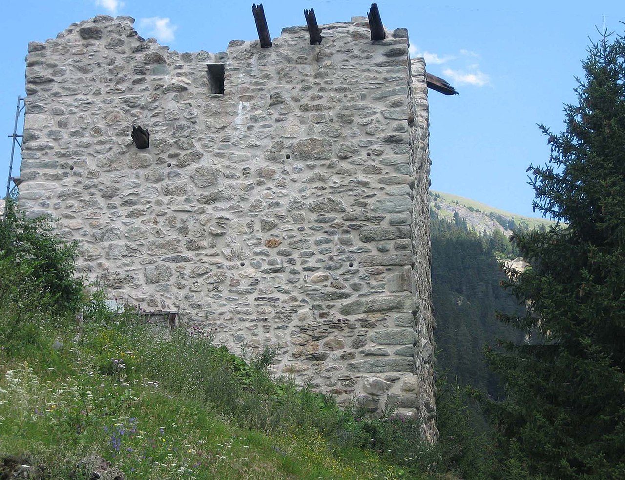
The ruin of La Tur Castle is located in the municipality of Zillis-Reischen in Schams, in the Swiss canton of Graubünden. The ruin of La Tur Castle lies on the southern edge of the Vidostobel gorge directly above Reischen, a hamlet of the village of Zillis. It can be reached by a footpath that branches off to the right at the end of the village, in about twenty minutes.
What remains is a three-story, square tower with sides measuring a good 8 meters and a wall thickness of 2 meters, which decreases with increasing height. The large corner bosses with precise edge dressing are striking. The tower can be entered through an entrance that was broken out later. Inside, square beam holes indicate the position of the floors.
Beam remnants on the west wall show the course of a gallery. A high entrance was located on the northwest side. The tower was illuminated by only a few narrow loopholes.
At the foot of the tower, separated by a ditch, are the remains of a dry stone wall, which could have belonged to a pen.
There are no documentary references to the origin and history of the castle. However, it is likely older than the rebuilt Haselstein Castle on the other side of the gorge and may have been built as early as the 12th century. It is also not known when and why the castle was abandoned. Burnt beam remnants and traces of fire inside suggest a fire.
The sources regarding the noble family of Reischen are also very scarce. In 1275, the Reischen family, ministerials of the Bishop of Chur, are mentioned for the first time, with later mentions occurring from 1277 to 1446, where a Junker Hans von Reyschen is mentioned.
Given the inaccessible location of the castle high above the transit route from Thusis to Splügen and San Bernardino, La Tur could also have served as a refuge for the population.
In 2001, the association 'pro tur' was founded with the aim of preserving and securing the ruin. Security work has been underway for some time, but it has been suspended for a longer period (as of July 2007).
Take Mobile History with you
You are reading this text for free. Premium adds what matters on the road: descriptions read aloud, sites found through your camera, whole regions taken offline.
- Every description, including the ~17,700 Premium sites
- Audio guide: have descriptions read to you on location
- AR finder: see sites through your camera, with distance and bearing
- Unlimited saved sites
14 days free, then from €2.99 a month. Cancel anytime.
Source: Wikipedia · Licence: CC BY-SA 4.0 · Image: upload by Adrian Michael / CC BY-SA 3.0 via Wikimedia Commons
This description draws on the facts documented in the linked Wikipedia article; Wikipedia content is licensed under CC BY-SA 4.0. Wording and editing: Mobile History.
Location: 46.6401, 9.4562