CastleWenslingen

Ödenburg Castle (Ruin)
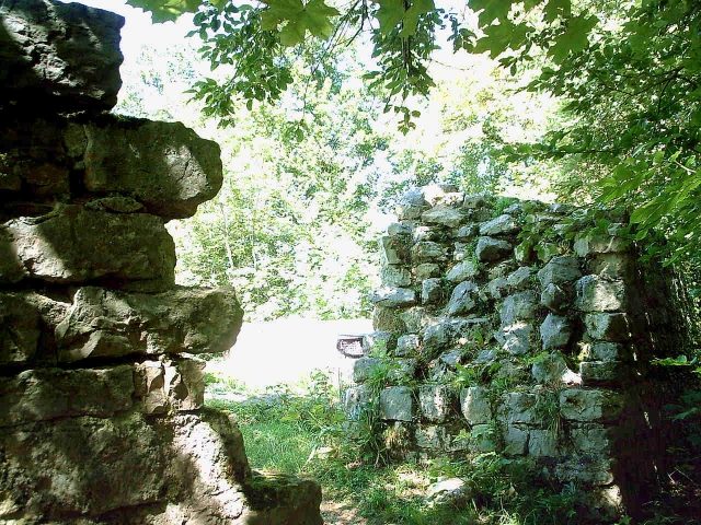
Ödenburg Castle (Ruin)

The remains of the Castle can be visited

The Ödenburg (also called Heltburg (Aegidius Tschudi, 1535), Oltenburg (Wurstisen, 1580), Ödenburg or Altschloss) is a castle ruin from the 10th century, located halfway between the villages of Wenslingen and Tecknau in the Swiss canton of Basel-Landschaft.

West of the village of Wenslingen and high above the village of Tecknau, the Ödenburg lies on a prominent rock spur. From both villages, the ruin is easily accessible via hiking trails after a short walk (signposted).

Due to its spur location, the Ödenburg had a roughly triangular layout and was naturally protected on the north and southwest sides by rock faces and steep terrain. Only the southeast side had to be artificially protected by a neck ditch as an obstacle to approach. Behind the neck ditch rose a shield wall almost 2 meters thick. Access to the castle was on the north side through an ascending, vaulted passage in the gate tower (see picture). Due to the still visible gate hinge sockets in the gate system, a two-winged gate can be assumed. The gate was about 2 meters above the ground level at the time. The former path to the gate is no longer traceable: Meyer assumes that a slipped ramp allowed access to the gate (from the left in the picture), while Strübin considers a steep wooden construction (drawbridge?) possible, which could have led from steps below the gate entrance to the gate.

Traces of several houses have been found within the castle. Their construction techniques varied greatly; in addition to stone houses, wooden houses and a pit house were also found.

The clear traces of quarrying activity in the neck ditch are interesting. As with many medieval castles, the building material was extracted as close as possible to the construction site. An artificial deepening of the neck ditch served a double purpose: it not only enabled the protective function but also provided building material for the fortress.

The source material for this old ruin is very scarce; not even the original name is known: The castle was already abandoned around 1150, at a time when written documents were still very rarely produced. Nevertheless, Strübin and Pümpin assume that the name Heltburg (from Held, meaning hero) comes close to the original name. When the ruin was overgrown by the forest and the original name fell into oblivion, the castle site was popularly referred to as an "öde Burg" (desolate castle), which led to the current name.

Based on the archaeological finds, the site can be assumed to have been in use between the end of the 10th century and the end of the 12th century. During his excavation in one part of the site, Pümpin found undated burn marks from a conflagration.

The ruin was in the possession of the House of Habsburg-Laufenburg in 1320. However, the castle was probably founded by the Counts of Homberg, whose fiefdom reverted to Habsburg-Laufenburg with the extinction of the Hombergs in 1223.

Due to the situation (incomplete ring wall, open space in the castle courtyard, quarry in 'full operation', etc.), it is assumed that the castle was abandoned in the middle of an expansion phase: this was by no means due to military actions, but rather to financial problems and/or shifts in the politics and spheres of influence of the noble families.

Excavation and restoration work on the ruin took place in 1941/42 (Fritz Pümpin), 1968 (Karl Heid and Theodor Strübin), and from 1976 to 1979 (Jürg Tauber).

Take Mobile History with you

You are reading this text for free. Premium adds what matters on the road: descriptions read aloud, sites found through your camera, whole regions taken offline.

  • Every description, including the ~17,700 Premium sites
  • Audio guide: have descriptions read to you on location
  • AR finder: see sites through your camera, with distance and bearing
  • Unlimited saved sites

14 days free, then from €2.99 a month. Cancel anytime.

Source: Wikipedia · Licence: CC BY-SA 4.0

This description draws on the facts documented in the linked Wikipedia article; Wikipedia content is licensed under CC BY-SA 4.0. Wording and editing: Mobile History.

Location: 47.4418, 7.8945