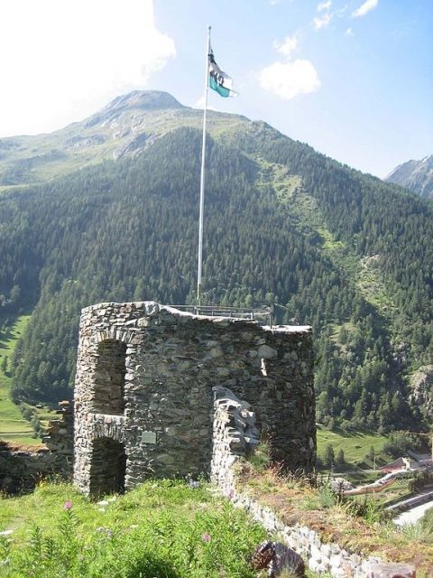
The remains of the Castle can be visited
Rohan Castle (Ruin) (Susch)

The Fortezza (fortress) Rohan is a ruin east of Susch in the Engadin in the Swiss canton of Graubünden. It is located on the Chaschinas hill above the village at approximately .
The complex was built in 1635 by Duke Henri II de Rohan during the Thirty Years' War, amidst the Bündner Wirren and the struggles for the reconquest of the Veltlin, to provide rear cover against the Spanish and Austrians. A bulwark constructed between May 19 and 27, 1635, by Captain Borel de la Roque-Servière and Georg Jenatsch, likely served as provisional preparatory work for the Fortezza. After the cessation of hostilities, the fortress was abandoned.
It is unclear whether a defensive structure stood on the hill earlier; any remains would have been removed by the 1635 construction. Only excavations could provide information about older settlements.
The original wall height of the star-shaped fortress is still preserved in places and varies between 2.5 and 5 meters. The surrounding wall is between 0.5 and 1.5 meters thick. Below the top of the wall ran a wooden battlement, whose horizontal support beams are still largely preserved. On the outside of the wall, numerous upward-sloping wooden props were intended to make the placement of assault ladders difficult. At the southwest corner stands a two-story round tower with a cellar room, on whose platform a cannon could have been placed.
The complex was divided into two approximately equal areas by a central wall with a passage. The main gate was in the southeastern part. A rectangular building, which was still standing in the 1930s, was destroyed during World War II by modern military installations, which have since been removed.
Take Mobile History with you
You are reading this text for free. Premium adds what matters on the road: descriptions read aloud, sites found through your camera, whole regions taken offline.
- Every description, including the ~17,700 Premium sites
- Audio guide: have descriptions read to you on location
- AR finder: see sites through your camera, with distance and bearing
- Unlimited saved sites
14 days free, then from €2.99 a month. Cancel anytime.
Source: Wikipedia · Licence: CC BY-SA 4.0
This description draws on the facts documented in the linked Wikipedia article; Wikipedia content is licensed under CC BY-SA 4.0. Wording and editing: Mobile History.
Location: 46.7483, 10.0835