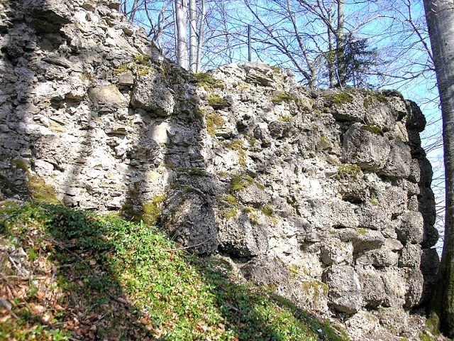
The remains of the Castle can be visited
Rothenfels Castle (Ruin)

The castle ruin Rothenfels is located on a wooded mountain spur northwest of Immenstadt in the Allgäu. The cultural monument, which is severely endangered in its substance, is freely accessible.
The hilltop castle was built in the second half of the 13th century by the Lords of Schellenberg. In 1273, the dominion passed to Rudolf von Habsburg and subsequently in 1332 to Count Wilhelm II von Montfort († 1354). Together with Hugofels Castle, which is only about 170 meters away, a double castle complex was built here.
The castle was destroyed by a lightning strike in 1462 and subsequently rebuilt. During the German Peasants' War (1525), the rebels unsuccessfully besieged the double castle. Count Wolfgang von Montfort is said to have retreated with his servants into the large residential tower of Hugofels Castle at that time. In 1546, troops of the Schmalkaldic League occupied the complex. In 1565, Count Ulrich, as the last of his line, sold the fortress to his brother-in-law Johann Jakob von Königsegg. After the Barons of Königsegg were elevated to Imperial Counts in 1629, the residence was moved down to the city palace in Immenstadt.
At the end of the 18th century, under Count Fidel von Königsegg, the roofs were removed to reuse the tile material. In 1816/18, the largely preserved castle complex was demolished, except for remnants, for the construction of a foal farm and a stud farm. In 1875, the city of Immenstadt finally acquired the castle ruin. The severely endangered remains of the large double castle were included in the concept of the newly developed Allgäu Castle Region in 2007 by setting up information boards.
Description+
The castle was built at 853 meters above sea level on a hill spur projecting to the east above the Kleiner Alpsee. To the south, west, and north, the fortress was effectively secured by very steep slopes. To the east, the narrow castle path leads to the former main gate, above which the few wall remains of the former keep have been preserved on a rock dome about 10 meters high. South of the completely vanished gate, the infill masonry of the front building is still visible.
The narrow castle courtyard behind this shield-wall-like front building was enclosed in a horseshoe shape by three-story residential buildings. Four round towers with conical roofs projected outwards. The main building material used was the Nagelfluh rock, which is ubiquitous in the area. Rubble stone was used as infill material. The castle quarry was located directly behind the partially preserved residential tower of the immediately adjacent Hugofels Castle, which was originally probably only an outwork of Rothenfels.
Between the two castles was a common outer bailey area with an outer gate. The area is still inhabited today.
To the west of the castle, a roughly four-meter-high section of wall made of mighty Nagelfluh ashlar blocks is preserved. A narrow embrasure breaks through the lowest stone layer of the exterior. On the plateau, the foundation remains continue eastward around a rectangular pit.
On the entire castle plateau, the rubble heaps from the demolition work of the early 19th century are visible. The few exposed wall remains urgently need securing. Like the neighboring Hugofels Castle, Rothenfels is also not entirely safe to visit. The archaeologically significant double castle complex is overall in a very dilapidated state. In 2007, however, as part of the expansion of the "Allgäu Castle Region", a modern information board was erected on the site.
A lithograph by Xaver Glötzle (around 1850/60) provides an impression of the castle complex at the beginning of the demolition work (approx. 1816). The keep, the ruins of the front building, and the perimeter development with a round tower are clearly recognizable.
Take Mobile History with you
You are reading this text for free. Premium adds what matters on the road: descriptions read aloud, sites found through your camera, whole regions taken offline.
- Every description, including the ~17,700 Premium sites
- Audio guide: have descriptions read to you on location
- AR finder: see sites through your camera, with distance and bearing
- Unlimited saved sites
14 days free, then from €2.99 a month. Cancel anytime.
Source: Wikipedia · Licence: CC BY-SA 4.0
This description draws on the facts documented in the linked Wikipedia article; Wikipedia content is licensed under CC BY-SA 4.0. Wording and editing: Mobile History.
Location: 47.5690, 10.2049