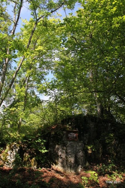
The remains of the Castle can be visited
Schalksburg Castle (Ruin)

The Schalksburg is a former spur castle located in the municipality of Straßberg, between Albstadt and Sigmaringen in the Zollernalbkreis district of Baden-Württemberg, Germany. The castle ruin is freely accessible and now serves as a viewpoint.
The ruin of the Schalksburg lies 760 meters above sea level on a mid-slope position, on a rocky spur projecting into the Schmeiental valley from a mountain corner, approximately 1.3 kilometers north of the church in Straßberg.
The origin of the "small" Schalksburg (also called Ödenburg) is dated, based on the evaluation of ceramic finds, to the first half of the 12th century. The original name and owner of the castle are not proven. A connection with the Lords of Schalksburg, documented since 1211, and their namesake castle between the Albstadt districts of Burgfelden and Laufen an der Eyach is now doubted. At its feet in the valley lay the village of Oitringen, first mentioned in 1264 and probably abandoned around 1500. The first written mention of the Schalksburg near Straßberg is found in 1333 in the property descriptions of Beuron Monastery. The abandonment of the castle as a residence must be assumed for the first half of the 13th century. In 1992 and 1993, the ruin was restored by the Jan von Werth working group from Straßberg.
Description+
The castle site consists of a long, westward-sloping rocky ridge that culminates in a steep high spur above the Schmeiental valley. A 20-meter-long neck ditch, through which a narrow road now runs, delimits the castle area on the mountain side. Several rock steps and leveled slope terraces to the south and north suggest the location of buildings and an eastern tower behind the neck ditch. Centrally on the rocky ridge, above a shallow depression (the castle courtyard) with the presumed access gate to the south, stands a tower ruin approximately 7 x 7.40 meters in size. Preserved are the inner shell of the basement with well-crafted outer facing of small ashlar stones, as well as the approximately 5.50-meter-high core masonry of the north side and a large foundation wall remnant on the south side. This tower or keep stands in the center of an approximately 7 x 45 meter area of the former core castle, which extends on the rocky ridge from east to west. It is delimited there by a ditch-like cleft. Above this section ditch, on the western rock head of the spur tip, remains of a tower-like building are found. Access is provided by a series of rock steps carved out of the stone. On the northwestern outer edge, layers of small ashlar stones from the surrounding wall have been preserved. The barely meter-thick wall remnants suggest a maximum two-story tower house with a half-timbered superstructure and a floor area of approximately 7 x 7 meters.
Take Mobile History with you
You are reading this text for free. Premium adds what matters on the road: descriptions read aloud, sites found through your camera, whole regions taken offline.
- Every description, including the ~17,700 Premium sites
- Audio guide: have descriptions read to you on location
- AR finder: see sites through your camera, with distance and bearing
- Unlimited saved sites
14 days free, then from €2.99 a month. Cancel anytime.
Source: Wikipedia · Licence: CC BY-SA 4.0
This description draws on the facts documented in the linked Wikipedia article; Wikipedia content is licensed under CC BY-SA 4.0. Wording and editing: Mobile History.
Location: 48.1882, 9.0909