The remains of the Castle can be visited
CastleTecknau
Scheidegg Castle (Ruin)
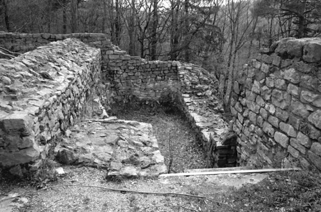
The Scheidegg ruin, a former hilltop castle, stands on a rock ridge near Tecknau in the Swiss canton of Basel-Landschaft. Its history and visible remains show a former noble residence, distinguished by its strategic location and construction.
History+
Scheidegg Castle was built in two main construction phases. Between 1220 and 1230, the southeastern part, including a residential tower, was erected. A generation later, after 1250, the northwestern bailey followed, featuring a courtyard, a filter cistern, and additional residential buildings that also included stables. Simultaneously, the residential tower was redesigned. The complex was a new foundation with no preceding structure. The owners, the Lords of Gelterkinden, cleared the land themselves, which allowed them a certain degree of self-sufficiency. Around 1300, the castle began to decline, and after a fire around 1320, it was finally abandoned. In the mid-14th century, the dilapidated complex was integrated into the Lordship of Farnsburg and first mentioned in a document in 1372. Extensive excavation and restoration work took place between 1970 and 1974.
Location+
The Scheidegg ruin is located at an elevation of approximately 559 meters above sea level, southwest of Tecknau in the Sissach district, canton of Basel-Landschaft, Switzerland.
Take Mobile History with you
You are reading this text for free. Premium adds what matters on the road: descriptions read aloud, sites found through your camera, whole regions taken offline.
- Every description, including the ~17,700 Premium sites
- Audio guide: have descriptions read to you on location
- AR finder: see sites through your camera, with distance and bearing
- Unlimited saved sites
14 days free, then from €2.99 a month. Cancel anytime.
Source: Wikipedia · Licence: CC BY-SA 4.0
This description draws on the facts documented in the linked Wikipedia article; Wikipedia content is licensed under CC BY-SA 4.0. Wording and editing: Mobile History.
Location: 47.4477, 7.8779