The remains of the Castle can be visited
CastleHohentengen
Weißwasserstelz Castle (Ruin)
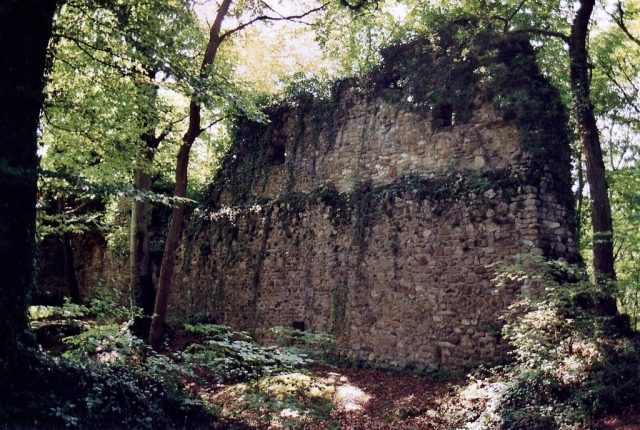
The castle ruin Weisswasserstelz is a castle ruin on a high hill on the right northern bank of the Rhine near Hohentengen am Hochrhein in the district of Waldshut in Baden-Württemberg.
The hill castle was built in the 12th century by the Reichenau ministerialis family of Wasserstelz. In 1170, a Wernherus de Wasserstelce is mentioned in documents. In 1343, Abbot Eberhard von Reichenau, as feudal lord of Wasserstelz Castle and the associated estate including the church patronage in Lienheim, approved the transfer to Adelheid von Usenberg. In 1347, Abbot Eberhard granted Wasserstelz Castle with its associated possessions to Ulrich Winkelshain, who had bought them for 260 Marks of Schaffhausen measure.
The castle was then temporarily owned by the Lords of Griessen, also called Griessheim. This is evident from a document from 1373. In it, the knight Hermann von Grießheim arranged for his son, who was under the guardianship of Johann von Krenkingen, to receive Wasserstelz Castle as a fief from the Reichenau monastery.
In 1451, the castle went as a fief to Hans Heggenzi, later it went to the Prince-Bishopric of Constance. In 1639, during the Thirty Years' War, the castle was blown up and from 1781 onwards it fell into disrepair and served for a long time as a quarry. The Lords of Wasserstelz were also the builders of Rotwasserstelz Castle and Schwarzwasserstelz Water Castle, which was demolished in 1875.
Source: Wikipedia · Licence: CC BY-SA 4.0
This description draws on the facts documented in the linked Wikipedia article; Wikipedia content is licensed under CC BY-SA 4.0. Wording and editing: Mobile History.
Location: 47.5776, 8.4014