The Tower can be visited
Town Fortification Magdeburg-Tatarenturm
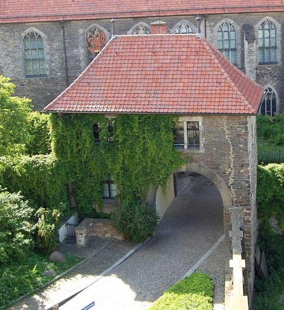
The Tatarenturm (Tatar Tower) is a former defensive tower of the city fortifications of Magdeburg's Old Town.
According to the Schöppenchronik (Lay Judges' Chronicle), the tower was built in 1239, or according to other sources in 1241, at the instigation of Archbishop Wilbrand von Käfernburg as part of measures to fortify the city in view of feared attacks by Tatars. It is thus significantly older than the other two defensive towers, Kiek in de Köken and Turm hinter der Ausfahrt der Möllenvogtei, preserved in the immediate vicinity. To the west of the tower is Magdeburg Cathedral; to the east was originally the lower-lying foreland to the Elbe. The Tatarenturm stood at the southern end of the retaining wall that supported the higher cathedral area against the Elbe foreland, on whose ground the tower was founded. The lower part of the tower was then probably covered by an embankment in 1536 as part of the construction work for the Cleve Bastion, located slightly to the south.
In the 18th century, when the defensive towers had long since lost their original military function, the Fürstenwall with casemates and a promenade was built to the east of the tower. In 1899, a gate passage was led from the Remtergang to the west, through the first upper floor of the tower, to the Fürstenwall, in order to connect the area around the Domplatz with the Fürstenwall. For this purpose, the ground on the east side was raised by about 4 to 5 meters. The Tatarenturm was heavily rebuilt and today appears from the Fürstenwall like a two-story house. The Tatarenturm is covered with a hip roof. The total height of the tower is 11.0 meters, with a rectangular footprint of 10.2 by 6.0 meters. The masonry, built from red sandstone rubble, has a wall thickness of about 1.3 meters. In the basement of the tower there is a vault with a window on the northern side. On the upper floor, on the west side, next to the passage, the remains of a bricked-up round arch can be seen. On the northern side of the second upper floor, the graywacke-made reveal of a bricked-up window is still visible.
Take Mobile History with you
You are reading this text for free. Premium adds what matters on the road: descriptions read aloud, sites found through your camera, whole regions taken offline.
- Every description, including the ~17,700 Premium sites
- Audio guide: have descriptions read to you on location
- AR finder: see sites through your camera, with distance and bearing
- Unlimited saved sites
14 days free, then from €2.99 a month. Cancel anytime.
Source: Wikipedia · Licence: CC BY-SA 4.0 · Image: http://commons.wikimedia.org/wiki/File:Tartarenturm_Magdeburg.JPG
This description draws on the facts documented in the linked Wikipedia article; Wikipedia content is licensed under CC BY-SA 4.0. Wording and editing: Mobile History.
Location: 52.1239, 11.6355