The City Wall can be visited
Town FortificationRaabs an der Thaya
Town Fortification Raabs an der Thaya
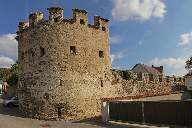
The City Walls+
Of the medieval city fortifications, which originally enclosed the former market in a rectangle, preserved and largely undeveloped sections have survived at the western corner and along the northeastern line. Along the southwestern line, the Thaya river partly served as a natural obstacle, replacing some of the walls. The preserved remains include rubble stone battlements with loopholes. At the northwest corner and at the Thaya bridge, there are still open-backed semicircular towers with battlements, and at the southeast corner, a round tower with a conical roof. The former western Spitzertor was demolished in 1855; the eastern Uhrtor in 1895.
Want to learn more about this site?
The full description is available with Premium — plus offline packages, audio guide and high-resolution images.
- Every description, including the ~17,700 Premium sites
- Audio guide: have descriptions read to you on location
- AR finder: see sites through your camera, with distance and bearing
- Unlimited saved sites
14 days free, then from €2.99 a month. Cancel anytime.
Already Premium and still locked?
Sign-in works per address. On mobilehistory.app you need to sign in once separately — your Premium then applies here too.
Sign in →Source: Wikipedia · Licence: CC BY-SA 4.0 · Image: http://de.wikipedia.org/wiki/Liste_der_denkmalgesch%C3%BCtzten_Objekte_in_Raabs_an_der_Thaya#mediaviewer/Datei:Stadtmauer_in_Raabs_an_der_Thaya_bei_GstNr_167_SW_-_Pano.jpg
This description draws on the facts documented in the linked Wikipedia article; Wikipedia content is licensed under CC BY-SA 4.0. Wording and editing: Mobile History.
Location: 48.8478, 15.4916