Town FortificationBad Radkersburg

Town Fortification Radkersburg
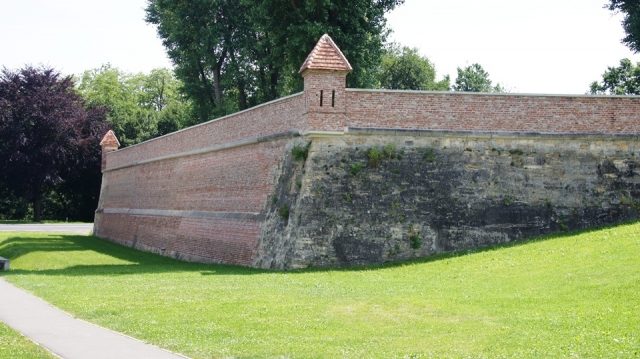
Town Fortification Radkersburg

The City Wall can be visited

Due to its border location with Hungary, Radkersburg had military-strategic importance from the very beginning and was already surrounded in the Middle Ages by a high ring wall with defensive towers. This fortress had the task of breaking a first assault by possible enemies from the southeast.

The first documented mention of Radkersburg dates back to 1182; the place was explicitly named as a city in a document in 1299. It can be assumed that the settlement was rebuilt, expanded, and fortified into a city according to a plan at the end of the 13th century. The conflicts with the Ottoman Empire in the 16th century and the emergence of new weapon technologies forced the renewal and modernization of the fortifications.

From 1546, the fortress of Radkersburg was expanded and rebuilt in the Italian bastion system. Additionally, water was diverted into the deep moat surrounding the city, which in turn increased the risk of floods. However, the Mur arm on the north side began to silt up from the 18th century onwards and eventually disappeared completely.

In 1582, Radkersburg was elevated to an Imperial Fortress at the Reichstag of Augsburg. Throughout the 16th and 17th centuries, the fortress repeatedly suffered great damage from floods and fires. It could never be completely finished, was often in very poor condition, and frequently had to be repaired. After the peace treaties with the Ottoman Empire, it finally lost its function and was dissolved in 1773.

Take Mobile History with you

You are reading this text for free. Premium adds what matters on the road: descriptions read aloud, sites found through your camera, whole regions taken offline.

  • Every description, including the ~17,700 Premium sites
  • Audio guide: have descriptions read to you on location
  • AR finder: see sites through your camera, with distance and bearing
  • Unlimited saved sites

14 days free, then from €2.99 a month. Cancel anytime.

Source: Wikipedia · Licence: CC BY-SA 4.0 · Image: http://www.wehrbauten.at

This description draws on the facts documented in the linked Wikipedia article; Wikipedia content is licensed under CC BY-SA 4.0. Wording and editing: Mobile History.

Location: 46.6884, 15.9901