The City Wall can be visited
Town FortificationRüthen
Town Fortification Rüthen-Hexenturm
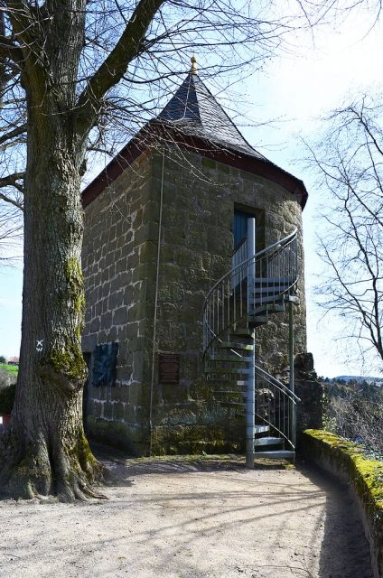
The Rüthen-Hexenturm town fortification once protected the town of Rüthen and today, particularly with the preserved Hexenturm (Witch's Tower), stands as a monument to the past.
History+
The medieval town fortification of Rüthen was constructed in the 14th century. It encompassed an approximately 3000-meter-long town wall that connected four town gates and eleven towers. This complex served to protect the inhabitants from attackers and robber knights, especially during conflicts such as the Soest Feud, the Thirty Years' War, and disputes between regional lords. The walls were between 1.20 and 1.80 meters wide and reached a height of 3.00 to 3.50 meters. The wall tapered towards the top, where a battlement with a parapet and embrasures provided protection. In less protected areas, where the town was not secured by natural steep slopes, double moats supplemented the defensive structures. Of the original fortification, the Hachtor gate, the semi-circular Hexenturm, and sections of the town wall remain today.
Source: Wikipedia · Licence: CC BY-SA 4.0 · Image: https://commons.wikimedia.org/wiki/File:R%C3%BCthen_Denkmal_Hexenturm_Seitenansicht_mit_neuer_Treppe.JPG
This description draws on the facts documented in the linked Wikipedia article; Wikipedia content is licensed under CC BY-SA 4.0. Wording and editing: Mobile History.
Location: 51.4909, 8.4250