The Town Fortification can be visited
Town FortificationSchongau
Town Fortification Schongau
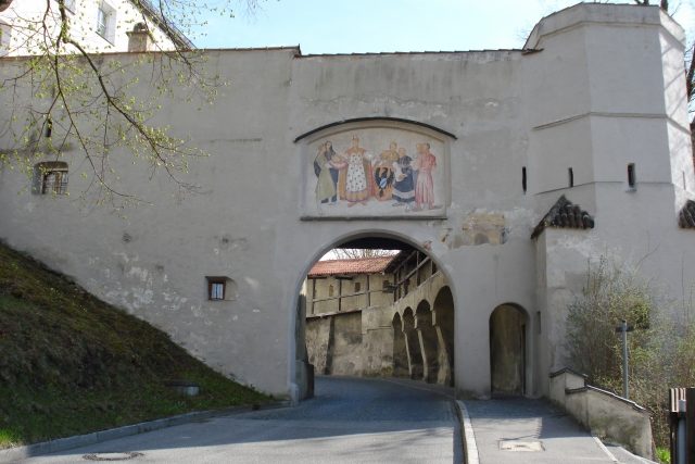
Schongau is a planned Staufer city, laid out after 1225. Three main street axes and the secondary streets assigned at right angles formed the core city of the 13th century. The expansion of the city took place in stages until the 14th/15th century. The entire northern part of the city between Bauerngasse, northern Münzstraße and northern Amtsgerichtsstraße and the smaller southern part around Lindenplatz were consequently connected. Later, the city lords also included the castle and the toll station northwest near Maxtor. This is still clearly visible today by a bulge in the city's layout at this point. The wall ring, which was largely built with battlements in the 13th century, is almost completely preserved.
Want to learn more about this site?
The full description is available with Premium — plus offline packages, audio guide and high-resolution images.
- Every description, including the ~17,700 Premium sites
- Audio guide: have descriptions read to you on location
- AR finder: see sites through your camera, with distance and bearing
- Unlimited saved sites
14 days free, then from €2.99 a month. Cancel anytime.
Already Premium and still locked?
Sign-in works per address. On mobilehistory.app you need to sign in once separately — your Premium then applies here too.
Sign in →Source: Wikipedia · Licence: CC BY-SA 4.0
This description draws on the facts documented in the linked Wikipedia article; Wikipedia content is licensed under CC BY-SA 4.0. Wording and editing: Mobile History.
Location: 47.8129, 10.8970