Town FortificationWolframs-Eschenbach

Town Fortification Wolframs-Eschenbach
This site has no photo yet. Sign in to contribute one.

The City Wall can be visited

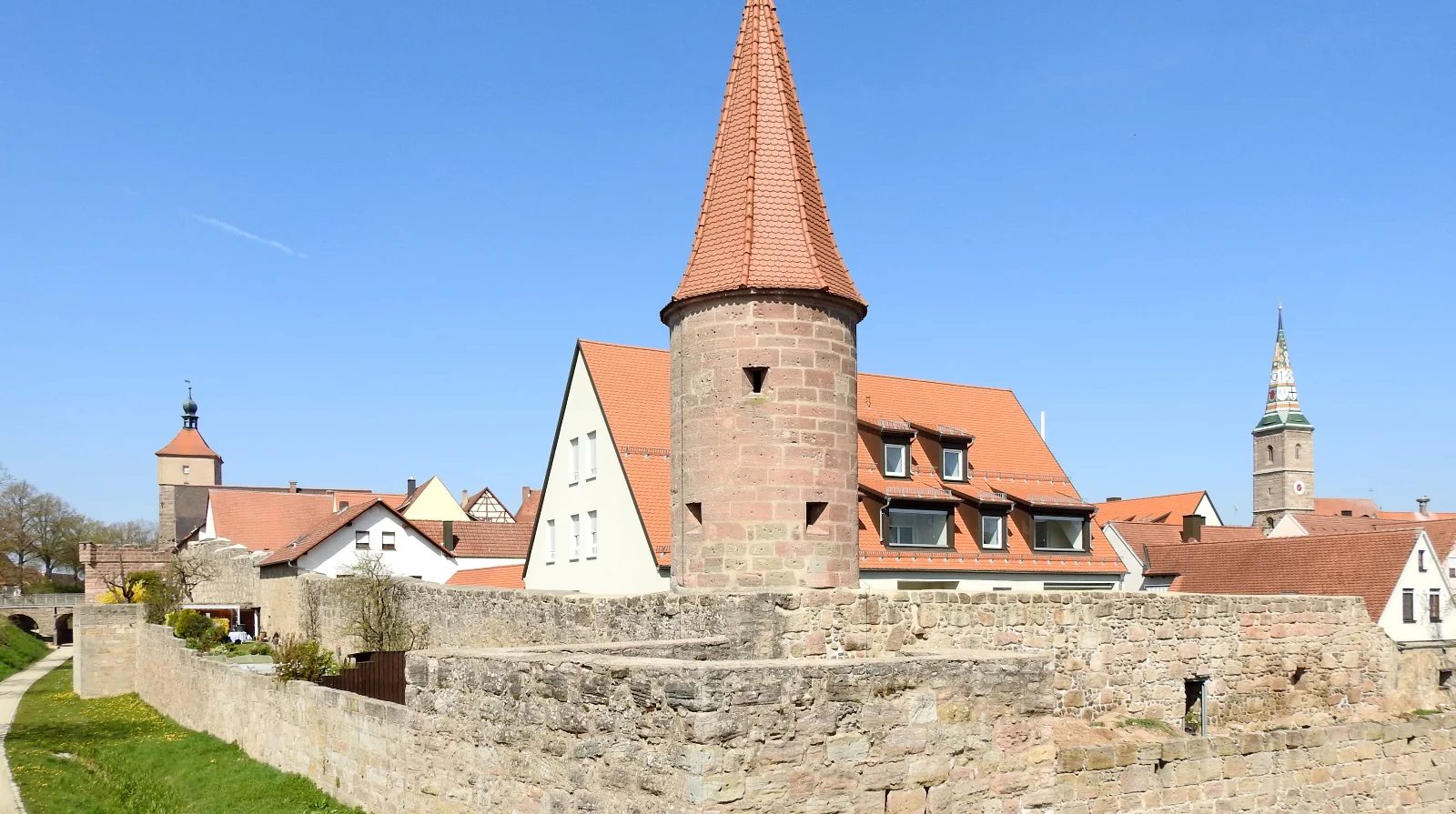
Around 1306, the small commandery of the Teutonic Order in Eschenbach was dissolved, and its possessions were placed under the wealthy, influential Order house in Nuremberg, which gradually acquired all of Eschenbach and administered it through a vogtei office. In 1332, "the brothers of the Teutonic Order," as already mentioned, received the right from Emperor Ludwig the Bavarian to "make a city" out of Eschenbach. The ruler granted a request from the Order brother Heinrich von Zipplingen, who, as Franconian Landkomtur, was the highest Order master in Franconia. Ditches, towers, and walls were essentially built between 1332 and 1440. In the area of the Upper Gate, the defiant defensiveness of the city's fortifications is still clearly visible today.

The deep ditch, the massive gate tower, the high inner wall, further reinforced with a zwinger and a second outer wall, convey the impression that Eschenbach was literally expanded into a fortress. The multi-part nature and the extent of the structuring make the defensive system a work of art.
The Lower Gate Tower presents on the field side, on the right hand, the coat of arms of Count Konrad von Egloffstein, who was the highest Order master in German lands from 1396 to 1416, known as the Deutschmeister; on the left hand, one sees the coat of arms of Count Ludwig von Wertheim, who held the office of Franconian Landkomtur from 1407 to 1419. At the beginning of the 16th century, the south flank of the city wall was reinforced with the Hungerturm and the Bürgerturm. The Upper Gate Tower shows on the field side, on the right hand, the coat of arms of the Teutonic Order, on the left hand, the coat of arms of Philipp von Bickenbach, who held the rank of Deutschmeister from 1361 to 1375.

Take Mobile History with you

You are reading this text for free. Premium adds what matters on the road: descriptions read aloud, sites found through your camera, whole regions taken offline.

  • Every description, including the ~17,700 Premium sites
  • Audio guide: have descriptions read to you on location
  • AR finder: see sites through your camera, with distance and bearing
  • Unlimited saved sites

14 days free, then from €2.99 a month. Cancel anytime.

Source: Wikipedia · Licence: CC BY-SA 4.0

This description draws on the facts documented in the linked Wikipedia article; Wikipedia content is licensed under CC BY-SA 4.0. Wording and editing: Mobile History.

Location: 49.2256, 10.7238