FortressUithoorn

Defence Line of Amsterdam-Fort aan de Drecht
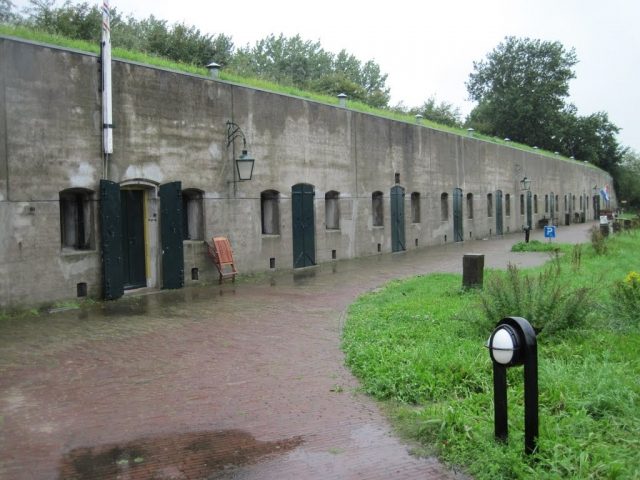
Defence Line of Amsterdam-Fort aan de Drecht

The Fort can be visited

The UNESCO World Heritage Site known as the Defence Line of Amsterdam (in Dutch named Stelling van Amsterdam) is a 135 km long ring of fortifications around Amsterdam, consisting of 42 forts located between 10 to 15 kilometers the centre, and lowlands that can easily be flooded in time of war. The flooding was designed to give a depth of about 30 cm, insufficient for boats to traverse. Any buildings within 1 km of the line had to be made of wood, so that they could be burnt and the obstruction removed.

The Stelling van Amsterdam was constructed between 1880 and 1920. The invention of the aeroplane and tank made the forts obsolete almost as soon as they were finished. Many of the forts now are under the control of the town councils and the nature department, and may be visited. Monuments Day, on the second Saturday in September, is the ideal day to visit as entrance is free.

The Fort along the Drecht was completely restored in 2000, after which it was given a multi-purpose function. Now the Amstelfort restaurant (open Tuesday through Saturday), a wine tasting company, art gallery, studio, exhibition space in the gorge casement and various businesses all enjoy a place in the fort. The Fort along the Drecht also offers a variety of events, from glass blowing workshops to wine tastings.

The Fort along the Drecht originated in 1911. The stronghold’s function was to defend the accesses formed by the rivers Drecht and Kromme Mijdrecht along with the dikes that run alongside them. The fort also served as protection for two nearby sluices, which now no longer exist. Still present is a bent armour plate of cast nickel steel, which is 20 centimetres (8 inches) thick and weighs 23,000 kilos (50,000 pounds).

Parking on the fort’s grounds is not allowed. You can park your car in the designated parking bays. If they are full, you can park at rowing club Michiel de Ruyter (Amsteldijk Zuid). From there, take the gravel path to get to the fort.

More information is available here.

Take Mobile History with you

You are reading this text for free. Premium adds what matters on the road: descriptions read aloud, sites found through your camera, whole regions taken offline.

  • Every description, including the ~17,700 Premium sites
  • Audio guide: have descriptions read to you on location
  • AR finder: see sites through your camera, with distance and bearing
  • Unlimited saved sites

14 days free, then from €2.99 a month. Cancel anytime.

Source: Wikipedia · Licence: CC BY-SA 4.0

This description draws on the facts documented in the linked Wikipedia article; Wikipedia content is licensed under CC BY-SA 4.0. Wording and editing: Mobile History.

Location: 52.2287, 4.8143