FortressKudelstaart

Defence Line of Amsterdam-Fort Kudelstaart
Defence Line of Amsterdam-Fort Kudelstaart

The Fort can be visited

The UNESCO World Heritage Site known as the Defence Line of Amsterdam (in Dutch named Stelling van Amsterdam) is a 135 km long ring of fortifications around Amsterdam, consisting of 42 forts located between 10 to 15 kilometers the centre, and lowlands that can easily be flooded in time of war. The flooding was designed to give a depth of about 30 cm, insufficient for boats to traverse. Any buildings within 1 km of the line had to be made of wood, so that they could be burnt and the obstruction removed.

The Stelling van Amsterdam was constructed between 1880 and 1920. The invention of the aeroplane and tank made the forts obsolete almost as soon as they were finished. Many of the forts now are under the control of the town councils and the nature department, and may be visited. Monuments Day, on the second Saturday in September, is the ideal day to visit as entrance is free.

Both the Fort near Kudelstaart and the Fort along the Winkel are being used by Vafamil (a foundation that offers holiday facilities to the military), respectively as a marina and a campground. The engineer depot, which was restored in 1994, is in use as an art gallery. The fort itself is not accessible to the public.

The Fort near Kudelstaart functioned as a defence for the Herenweg (road) and Westeinderplassen (lakes).

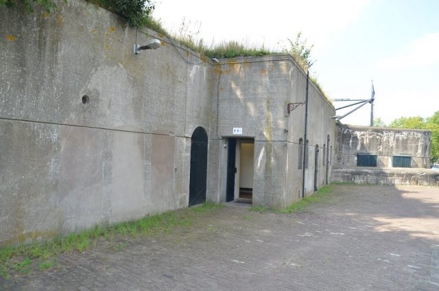
In the main building, a relatively large number of interior elements have been preserved. The Fort near Kudelstaart was completed in 1906. Besides the two blown-up gun turret buildings there are two concrete artillery positions located in the front wall. The wooden benches of the shelters are still present.

More information is available here.

Take Mobile History with you

You are reading this text for free. Premium adds what matters on the road: descriptions read aloud, sites found through your camera, whole regions taken offline.

  • Every description, including the ~17,700 Premium sites
  • Audio guide: have descriptions read to you on location
  • AR finder: see sites through your camera, with distance and bearing
  • Unlimited saved sites

14 days free, then from €2.99 a month. Cancel anytime.

Source: Wikipedia · Licence: CC BY-SA 4.0

This description draws on the facts documented in the linked Wikipedia article; Wikipedia content is licensed under CC BY-SA 4.0. Wording and editing: Mobile History.

Location: 52.2482, 4.7568