FortressHaarlemmerliede

Defence Line of Amsterdam-Fort Penningsveer
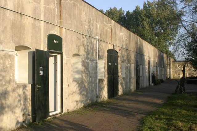
Defence Line of Amsterdam-Fort Penningsveer

The Fort can not be visited

The UNESCO World Heritage Site known as the Defence Line of Amsterdam (in Dutch named Stelling van Amsterdam) is a 135 km long ring of fortifications around Amsterdam, consisting of 42 forts located between 10 to 15 kilometers the centre, and lowlands that can easily be flooded in time of war. The flooding was designed to give a depth of about 30 cm, insufficient for boats to traverse. Any buildings within 1 km of the line had to be made of wood, so that they could be burnt and the obstruction removed.

The Stelling van Amsterdam was constructed between 1880 and 1920. The invention of the aeroplane and tank made the forts obsolete almost as soon as they were finished. Many of the forts now are under the control of the town councils and the nature department, and may be visited. Monuments Day, on the second Saturday in September, is the ideal day to visit as entrance is free.

The Fort near Penningsveer is a provincial monument. The wooden fort watchman's house is the sole Defence Line property that has two floors with living facilities. After the Second World War, the fortress was used for a while as an internment camp for collaborators. Today, the fort serves as group accommodation for schools and institutions who hold training courses and events. Some of the rooms are rented out to small (starting) companies.

The Fort near Penningsveer is not freely accessible. However, tours are available by appointment.

The Fort near Penningsveer was built between 1895 and 1901. From 1913 to 1922, it was manned on a permanent basis. North of the fort, along the Lagedijk (dike), you can find a concrete secondary battery and accommodation that offered protection against fragmentation ammunition. South of the fort there are inlet sluices that could be used to flood the land with water from the river Liede for military purposes.

More information is available here.

Take Mobile History with you

You are reading this text for free. Premium adds what matters on the road: descriptions read aloud, sites found through your camera, whole regions taken offline.

  • Every description, including the ~17,700 Premium sites
  • Audio guide: have descriptions read to you on location
  • AR finder: see sites through your camera, with distance and bearing
  • Unlimited saved sites

14 days free, then from €2.99 a month. Cancel anytime.

Source: Wikipedia · Licence: CC BY-SA 4.0

This description draws on the facts documented in the linked Wikipedia article; Wikipedia content is licensed under CC BY-SA 4.0. Wording and editing: Mobile History.

Location: 52.3915, 4.6776