The Fort can be visited
FortressSpijkerboor
Defence Line of Amsterdam-Fort Spijkerboor
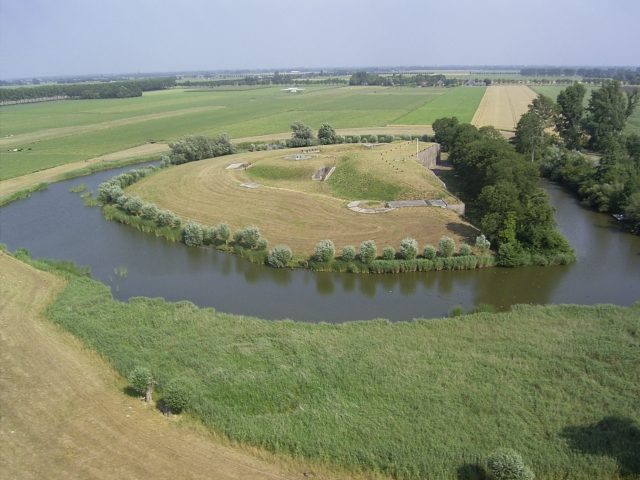
Fort Spijkerboor, an integral part of Amsterdam's former defense line, is a fortress in the province of Noord-Holland. It is the only fort in the entire defense ring where visitors can explore an armored dome that once housed two 10.5 cm cannons.
History+
Fort Spijkerboor was constructed as part of the Stelling van Amsterdam, a defense ring approximately 135 kilometers long designed to protect the Dutch capital. The construction of the earthwork was completed in 1895, and the bomb-proof main building was fully erected by 1911. Originally conceived to secure dikes and roads along the Beemsterringvaart and Noord-Holland canals, it served as a central stronghold in the northern section of the defense line. Although the Stelling was never militarily deployed, Fort Spijkerboor was later used as a prison and detention center for soldiers. After World War II, collaborators were imprisoned here, evidenced by the bars and wall paintings in the postern. From 1947, it housed conscientious objectors designated for Dutch East Indies. The entire Stelling van Amsterdam was declared a UNESCO World Heritage Site in 1996.
Location+
Fort Spijkerboor is situated near Spijkerboor in the province of Noord-Holland, within the West-Nederland region of the Netherlands.
On site+
The fort is accessible to visitors. It has recently undergone renovation. Visitors can participate in guided tours by appointment, during which the armored dome with its cannons can be discovered. On specific days in June, August, and September, as well as during special events, the fort is open to the public.
Take Mobile History with you
You are reading this text for free. Premium adds what matters on the road: descriptions read aloud, sites found through your camera, whole regions taken offline.
- Every description, including the ~17,700 Premium sites
- Audio guide: have descriptions read to you on location
- AR finder: see sites through your camera, with distance and bearing
- Unlimited saved sites
14 days free, then from €2.99 a month. Cancel anytime.
Source: stellingvanamsterdam.nl
Text and/or image for this object come from the linked site and are used with the permission of its operators; the linked page remains the copyright of its authors. The legacy catalogue kept text source and image source in a single field, so which part came from there can no longer be told apart entry by entry.
Location: 52.5404, 4.8417