The Fort can be visited
Defence Line of Amsterdam-Fort Uitermeer
The UNESCO World Heritage Site known as the Defence Line of Amsterdam (in Dutch named Stelling van Amsterdam) is a 135 km long ring of fortifications around Amsterdam, consisting of 42 forts located between 10 to 15 kilometers the centre, and lowlands that can easily be flooded in time of war. The flooding was designed to give a depth of about 30 cm, insufficient for boats to traverse. Any buildings within 1 km of the line had to be made of wood, so that they could be burnt and the obstruction removed.
The Stelling van Amsterdam was constructed between 1880 and 1920. The invention of the aeroplane and tank made the forts obsolete almost as soon as they were finished. Many of the forts now are under the control of the town councils and the nature department, and may be visited. Monuments Day, on the second Saturday in September, is the ideal day to visit as entrance is free.
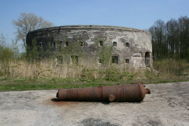
Fort Uitermeer is not accessible to the public. However, located right next to the fort is the restaurant Uit & Meer. Situated along the river Vecht, it offers a great view of the restored Tower Fort Uitermeer (1873), which was partly brought back to its former glory, as well as the historic sluice and part of the old canal. The Stichting Uitermeer (Uitermeer Foundation) has turned it into a beautiful restaurant.
Fort Uitermeer’s function was to defend the 's-Gravelandsche Vaart, the road running alongside this canal and the railway line Amsterdam-Hilversum. At this point the 's-Gravelandse Vaart flows into the river Vecht via a sluice. As early as the 16th century, this sluice was defended by a ‘sconce’ (small protective fortification made of earth). In 1672 (known as the ‘disaster year’ in Dutch history) the sconce was reinforced and a year later it was replaced by a permanent fort, which was constructed around the sluice. In 1815 the fort became part of the New Dutch Waterline. After the Second World War explosives were detonated inside the fort, causing severe damage. During the Cold War, ammunition depots were put up on the grounds of the fort. In 1959 the fortress lost its function as a defensive structure.
More information is available here.
Take Mobile History with you
You are reading this text for free. Premium adds what matters on the road: descriptions read aloud, sites found through your camera, whole regions taken offline.
- Every description, including the ~17,700 Premium sites
- Audio guide: have descriptions read to you on location
- AR finder: see sites through your camera, with distance and bearing
- Unlimited saved sites
14 days free, then from €2.99 a month. Cancel anytime.
Source: Wikipedia · Licence: CC BY-SA 4.0
This description draws on the facts documented in the linked Wikipedia article; Wikipedia content is licensed under CC BY-SA 4.0. Wording and editing: Mobile History.
Location: 52.2929, 5.0821