The Fortress can be visited
Museum
FortressVardø
Vardøhus Fortress
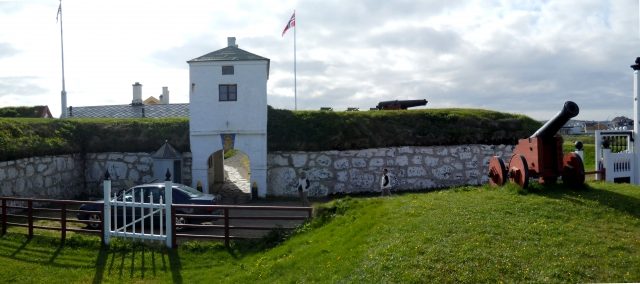
In Vardø, in the Norwegian region of Finnmark, is Vardøhus Fortress. It is considered the easternmost and northernmost fortress in the world.
History+
King Håkon V had the first Vardøhus Fortress built around 1300 to secure Norwegian interests on the Northeast Passage against Novgorod. Its completion was initially dated to 1307, but newer archaeological findings also suggest 1330 as probable. In 1326, funds intended for a crusade against Russians and Karelians were instead used for the construction of the first fortress. This consisted of a 30 by 40 meter rectangular area, surrounded by a four-meter-high and two-meter-thick wall, enclosing several buildings and a well. In the 17th century, the fortress was the scene of witch trials, in which almost 80 women were executed. The current octagonal fortress was completed in 1738; its buildings all date from before 1825. In 1769, the Jesuit Maximilian Hell used the fortress for astronomical observations of the transit of Venus. During World War II, the fortress was used to defend the coastal radio station Vardø-Radio and was the last Norwegian unit to hoist the free Norwegian flag, even after the country's capitulation.
On site+
Vardøhus Fortress is accessible to visitors and houses a museum. It also serves as a school for the naval forces and is the only fortress north of the Arctic Circle that fires a special two-shot salute when the sun appears fully above the horizon for the first time each year.
Take Mobile History with you
You are reading this text for free. Premium adds what matters on the road: descriptions read aloud, sites found through your camera, whole regions taken offline.
- Every description, including the ~17,700 Premium sites
- Audio guide: have descriptions read to you on location
- AR finder: see sites through your camera, with distance and bearing
- Unlimited saved sites
14 days free, then from €2.99 a month. Cancel anytime.
Source: Wikipedia · Licence: CC BY-SA 4.0
This description draws on the facts documented in the linked Wikipedia article; Wikipedia content is licensed under CC BY-SA 4.0. Wording and editing: Mobile History.
Location: 70.3721, 31.0953