The origins of the convent date back to 1201, when the foundation stone for this religious institution was laid. Throughout its history, Gnadenthal underwent various transformations. After the Reformation, it was converted into a Lutheran women's convent. Destruction and depopulation during the Thirty Years' War led to the abandonment of the convent in 1634. Subsequently, it served as a Nassau state domain and was used as a manor, until it was brought back to life in 1969 by the Jesus-Bruderschaft and has since housed a Christian community.
MonasteryHünfelden
Gnadenthal monastery
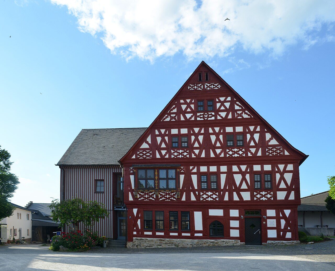
The former Cistercian convent of Gnadenthal in Hesse, a protected cultural monument, is a place of historical significance and spiritual continuity. It is picturesquely nestled in the German landscape and offers an insight into the monastic past of the region.
History+
Location+
Gnadenthal Convent is located in Hesse, Germany, at an elevation of approximately 186 meters above sea level. It is situated in the district of Dauborn, a part of the municipality of Hünfelden in the Limburg-Weilburg district, about three kilometers southeast of Dauborn.
On site+
Today, the grounds of the former convent are a vibrant center for the Jesus-Bruderschaft, an ecumenical community. It houses a retreat center, a youth guesthouse, a convent shop with an art gallery, a café, and the historic 13th-century convent church, which serves as an official cycling church.
Nearby+
- Steinscher Hof (Kirberg) (manor house, approx. 4022 m away)
- Kirberg Ruin (ruin, approx. 4220 m away)
- Wallrabenstein Ruin (ruin, approx. 4761 m away)
- Eichelbacher Hof Castle (Rod an der Weil) (castle, approx. 9838 m away)
Take Mobile History with you
You are reading this text for free. Premium adds what matters on the road: descriptions read aloud, sites found through your camera, whole regions taken offline.
- Every description, including the ~17,700 Premium sites
- Audio guide: have descriptions read to you on location
- AR finder: see sites through your camera, with distance and bearing
- Unlimited saved sites
14 days free, then from €2.99 a month. Cancel anytime.
Source: Wikipedia · Licence: CC BY-SA 4.0 · Image: Karsten Ratzke / CC0 via Wikimedia Commons
This description draws on the facts documented in the linked Wikipedia article; Wikipedia content is licensed under CC BY-SA 4.0. Wording and editing: Mobile History.
Location: 50.3093, 8.2152