Die Kirchenburg kann besichtigt werden
ChurchWeil der Stadt - Merklingen
Merklingen Church Castle
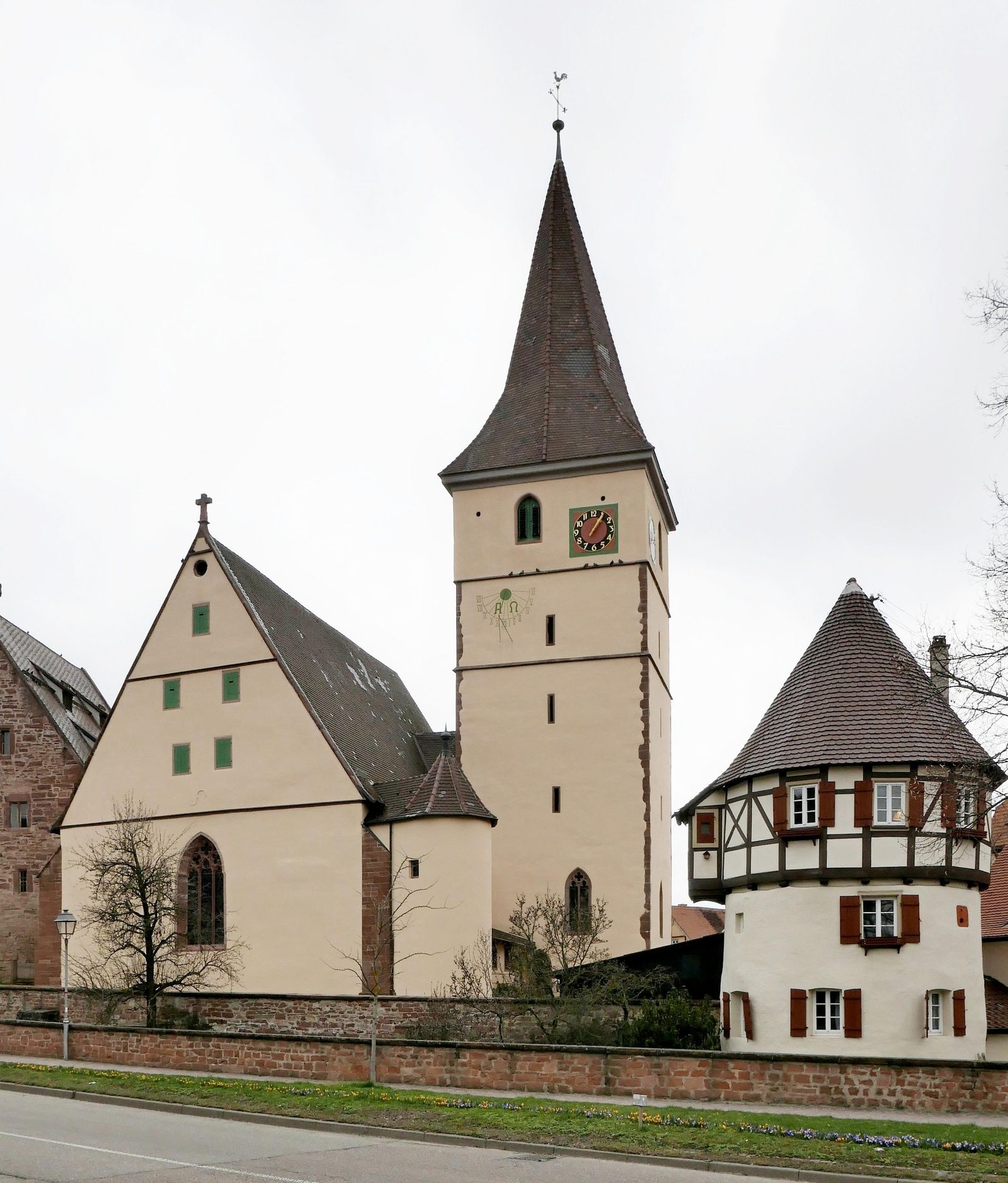
The fortified church of Merklingen is located in the Merklingen district of the municipality of Weil der Stadt in the Böblingen district in the Stuttgart administrative region in Baden-Württemberg. The complex, built in the Middle Ages, with a fortified church, curtain wall and moat, is relatively large and has a form rare for this region. Today it is one of the best preserved fortified churches in Southern Germany.
History+
The construction of the fortified church of Merklingen was initiated by Count Simon von Eberstein-Zweibrücken and once served as the administrative seat. Construction began in 1250 and was completed in 1278. In 1280, a stone house was built behind the church tower, in which the nobility lived. When the village of Merklingen was sold in 1296, the fortified church came into the possession of the Cistercian monastery of Herrenalb. For this reason, a coat of arms of the Eberstein counts and the Herrenalb monastery can still be seen today on the stone house, which was used by the monks as a granary. The coat of arms shows a rose and an abbot's staff. Later, the monastery used the castle as an agricultural complex. In 1417, a fire largely destroyed Merklingen, including parts of the castle complex.
Description+
Remigiuskirche+
The originally Romanesque parish church was named after Bishop Remigius of Reims, who was considered the Apostle of the Franks. In 1417, the church was completely destroyed in the fire. In 1425, the monastery built a choir tower church in the Late Gothic style on the same site. The reconstruction of the church presumably lasted until 1476. In 1595, the church was enlarged to the south during the expansion of the nave, and it contains Renaissance tombs of Merklingen bailiffs. In 1962/64, the church was fundamentally renovated. During the renovation, an apse and a stair tower were added and colored stained glass windows were installed. To this day, the medieval-looking church is well preserved.
Curtain Wall+
The curtain wall ran as a triple protective ring around the church and the stone house. It had one rondel to the east and two to the north. In the southern part of the middle ring is a semicircular tower, and to the west an abbot's house. A moat ran between the outer and middle walls. The moat system was supplied with water from the Würm river. Today, the Würm is canalized north of the town. The carp living in the moat at that time served as food, especially during Lent. The depth of the moat is still unknown today. The Merklingen cemetery was housed in the Zwinger between the inner protective wall and the middle ring. The inner protective wall was equipped with loopholes. In the following centuries, the old curtain wall was completely lost and the moat partially lost.
Defense Tower+
West of the gatehouse lies the defense tower, whose use was versatile. The lowest floor was used as a dungeon. One floor above was a detention cell. The third floor was used as the official residence of the sacristan of the Remigiuskirche. After the fire in 1417, the tower was partially rebuilt according to the old model with a half-timbered superstructure.
Nowadays+
The fortified church only reached its current size in the 18th century, when it came into the possession of the city, Weil der Stadt, and they renovated the castle for five million Marks. During the renewal of the foundations, skeletons and secret passages were found, leading from the stone house to the so-called "Großes Haus" outside the castle. Until the 1970s, the moat was filled in and used by residents as self-sufficiency gardens. Meanwhile, the moat has been re-excavated. The former drawbridges over the moat were replaced with stone bridges.
Take Mobile History with you
You are reading this text for free. Premium adds what matters on the road: descriptions read aloud, sites found through your camera, whole regions taken offline.
- Every description, including the ~17,700 Premium sites
- Audio guide: have descriptions read to you on location
- AR finder: see sites through your camera, with distance and bearing
- Unlimited saved sites
14 days free, then from €2.99 a month. Cancel anytime.
Source: Wikipedia · Licence: CC BY-SA 4.0 · Image: Werner Schüle · Wikimedia Commons · CC0
This description is a machine translation of an excerpt from the linked Wikipedia article. The source text was written by its authors, the translation is by Mobile History; like the original it is licensed under CC BY-SA 4.0.
Location: 48.7691, 8.8519