The remains of the Castle can be visited
CastleLa Garnache
Château de La Garnache
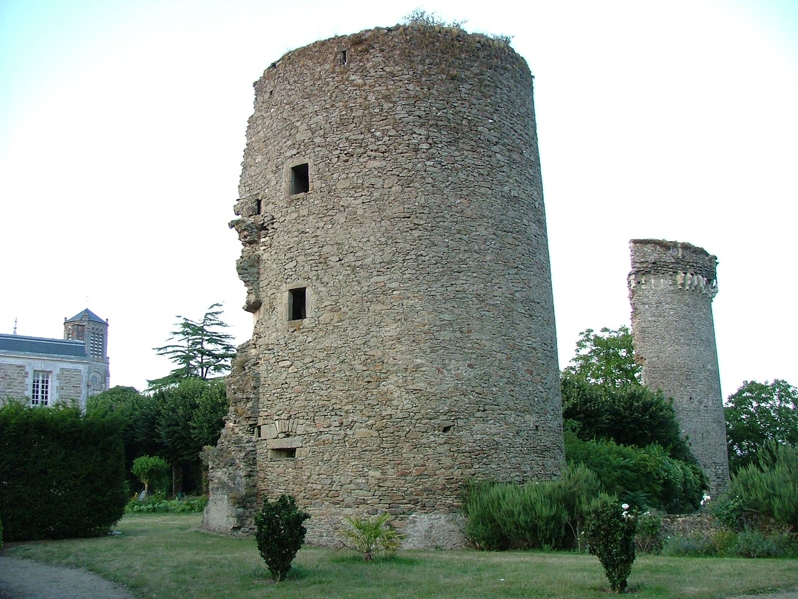
The Château ancien de La Garnache (also known as the Vieux château de La Garnache) is a ruined medieval fortress located in the commune of La Garnache, in the Vendée department of the Pays de la Loire region in western France. It stands in north-western Vendée near Challans, on a strategic site at the historic crossroads of Brittany, English-held Poitou and the kingdom of France, close to the salt marshes of the Marais Breton.
The site has been occupied continuously for more than two thousand years. Gallic Ambilâtres settled here; a Merovingian presence is attested from the 6th century (cemetery discovered on the feudal motte). A motte castrale (once up to 15 m high, still the highest in the canton at about 10 m) was raised, initially with a wooden castle, under the first known lords Gauthier and Goscelin in the 11th century. A stone fortress followed around 1045. Between roughly 1070 and 1214 a dynasty of six successive lords named Pierre rebuilt and fortified the castle in stone. In the 13th century it took its classic form: six round towers and one square keep linked by curtain walls, with a fortified town developing around it. It was one of the largest seigneuries in the region, controlling Challans, Beauvoir-sur-Mer and territories extending to Noirmoutier and the Île d’Yeu.
In the 14th century the castle was linked to Olivier de Clisson and his widow Jeanne de Belleville (“la Tigresse bretonne”), who sought revenge after Olivier IV’s execution in 1343. It was further improved in armament and decoration under Clisson influence. Later it passed to the powerful Breton house of Rohan and became a Protestant stronghold. It was damaged during the Wars of Religion (notably the siege of 1588–1589). In 1622 Louis XIII ordered its dismantling as a Huguenot base after fighting Benjamin de Rohan; the drawbridge and great tower were brought down and the stones were reused in local houses into the 19th century.
Today only ruins remain: a rare square keep, the halves of two round towers, sections of walls and part of the former protective pond. The towers have been inscribed as a Monument historique since 1925. A 19th-century bourgeois house occupies part of the northern park. The feudal motte survives nearby. The property is private (sold in 2021); the park remains publicly accessible. Guided visits are organised by the local heritage association, and the town has developed interpretation tools including virtual-reality experiences and historical frescoes recounting the long history of this major seigneury.
Take Mobile History with you
You are reading this text for free. Premium adds what matters on the road: descriptions read aloud, sites found through your camera, whole regions taken offline.
- Every description, including the ~17,700 Premium sites
- Audio guide: have descriptions read to you on location
- AR finder: see sites through your camera, with distance and bearing
- Unlimited saved sites
14 days free, then from €2.99 a month. Cancel anytime.
Source: Wikipedia · Licence: CC BY-SA 4.0 · Image: Cécile Didier · Wikimedia Commons · CC BY-SA 3.0
This description draws on the facts documented in the linked Wikipedia article; Wikipedia content is licensed under CC BY-SA 4.0. Wording and editing: Mobile History.
Location: 46.8888, -1.8334