The Fortress can be visited
CastleMühlbach
Mühlbacher Fortress
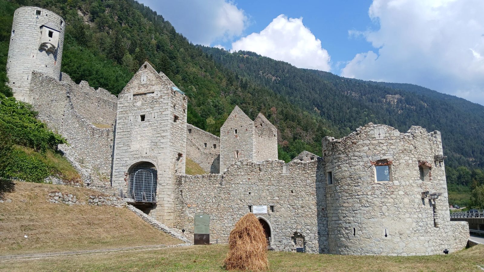
The castle ruin of the Mühlbacher Klause (Italian Chiusa di Rio di Pusteria) is an approximately rectangular barrier system with a fortified gate in the west (Mühlbacher Tor) and in the east (Vintler Tor) of the complex.
Location+
The Klause is located in Mühlbach (South Tyrol, Italy), a few kilometers north of Brixen at the transition from the Eisacktal to the Pustertal. According to some regional definitions, the complex is considered a border point between the two valleys.
History and Predecessor Systems+
The older, no longer preserved Mühlbacher Klause (also called "Haslacher Klause") was first mentioned in 1269 and built by the brothers Meinhard (later Meinhard II of Tyrol) and Albert of Görz, while the younger one (about 200 m further east of the older one) was built around 1460 by Duke Sigismund of Tyrol. Both marked the state border between Tyrol and Görz until 1500. Only with the death of the last Count of Görz did this function end. The Klause continued to be used as a fortress and road barrier or customs station. The country road led through the inner courtyard of the castle complex, where road tolls had to be paid. The customs station was significant because the medieval toll from travelers from Treviso and Venice was collected there. The Klause was a difficult obstacle to bypass not only for carts and wagons, but also for pedestrians, especially since a barrier wall, still visible today, stretched up the mountain. The Mühlbacher Klause is more than a mere customs station and saw many battles. For example, the Klause was unsuccessfully besieged in the Peasants' Wars in 1526. Due to battles in 1703 (War of the Spanish Succession) and 1809 (Tyrolean Rebellion against the Bavarian occupation), the barrier was severely damaged and not rebuilt. Instead, it was subsequently sold to citizens of Mühlbach and used as a "quarry". However, since mainly the inner structural parts were removed, the Klause is still quite impressive when viewed from the outside. Nevertheless, the Klause was never demolished, even though it often hindered the busy traffic into the Pustertal, as the state road led through the Klause. Attempts to renew the Klause repeatedly failed due to its relative insignificance, as it had been in the middle of Tyrol since 1500. Only the construction of a new road and its relocation outside the walls of the complex, as well as the commitment of some Mühlbach citizens, led to the restoration of the Klause starting in 1978. It can be assumed that in Roman times, an Augustan road barrier was located here on the road arm of the Via Julia Augusta leading from Aquileia via castrum Ursen (Irschen) to Veldidena (Wilten near Innsbruck), in order to control the road connection from friendly Noricum to hostile Raetia. The barrier wall lost its function, like those in Aguntum, after the Roman conquest of Raetia and its incorporation into the Roman Empire in 15 BC.
Complex+
It is divided into an upper, more fortified part and a lower, formerly inhabited, managed part. In the upper part, only the left round tower remains. The right one was destroyed during the construction of the Pustertal railway line, as was the barrier wall located outside the complex. In the lower part, the ground floor of the customs building is preserved, where a forge and stables were located. On the left side is the so-called Emperor's Tower. It is called this because Emperor Maximilian I is said to have stayed here during his hunting expeditions. On the road leading through the complex are the remains of a chapel (dedicated to the Trinity) and a toll stone.
Take Mobile History with you
You are reading this text for free. Premium adds what matters on the road: descriptions read aloud, sites found through your camera, whole regions taken offline.
- Every description, including the ~17,700 Premium sites
- Audio guide: have descriptions read to you on location
- AR finder: see sites through your camera, with distance and bearing
- Unlimited saved sites
14 days free, then from €2.99 a month. Cancel anytime.
Source: Wikipedia · Licence: CC BY-SA 4.0 · Image: Foto: Jörg Heldt (Community)
This description is a machine translation of an excerpt from the linked Wikipedia article. The source text was written by its authors, the translation is by Mobile History; like the original it is licensed under CC BY-SA 4.0.
Location: 46.8114, 11.6846